
✦ Mohave County, Arizona ✦
White Hills
Ghost Town
Established 1892 — Silver Rush Capital of the Hualapai Mountains
Location
Hualapai Mountains, Mohave County, AZ
Founded
1892 — Silver Rush
Peak Population
Over 1,500 residents (1893–1895)
Nearest Highway
US Hwy 93 / Interstate 11
✦ The Story of White Hills ✦
Born of Silver,
Swallowed by Sand
In 1892, a silver strike in the remote Hualapai Mountains of northwestern Arizona set off one of the last great mining rushes of the American West. Within months, a city of canvas tents and rough-hewn timber rose from the desert floor — White Hills was born.
At its peak, the town boasted hotels, saloons, a post office, a school, and a population of over 1,500 souls — all drawn by the promise of silver riches. Millions of dollars in ore were pulled from the earth and shipped out across the territory.
But the desert giveth and the desert taketh away. By 1896, the richest veins were exhausted. The miners moved on, the buildings fell silent, and White Hills began its slow surrender to the sun, wind, and sand.
Today, White Hills is one of the most evocative ghost towns in the American Southwest — a place where the legend of the Old West is not just remembered, but still very much alive.
✦ The Land & The Legend ✦
White Hills in Photos
The ruins, the desert, the mountains — a ghost town frozen in time along US Highway 93.
✦ White Hills at Its Peak ✦
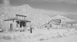
Person in Front of Building — White Hills, 1890s
White Hills Schoolchildren
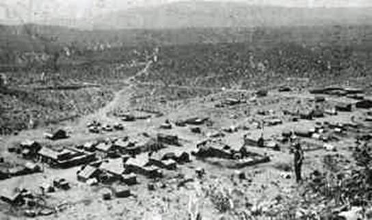
White Hills Downtown — View From Hilltop
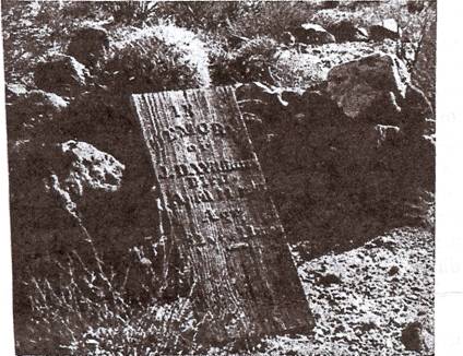
White Hills Cemetery — Grave Site
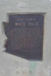
Official State Monument — White Hills
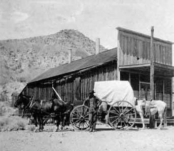
Covered Wagon — White Hills General Store
✦ Courtesy Mohave Historical Society ✦
History of White Hills
White Hills began unpromisingly when a Hualapai Indian cowboy by the name of Jeff, was casually asked by Judge Henry Schaeffer "if he knew of any good mine prospect."
The Arizona Republic correspondent in 1894, set many rumors aside when he interviewed Jeff, quoting the following:
"During the latter part of 1887, Hualapai Jeff was on his way to the head of the canyon (now camp White Hills) in search of paint that he had been told existed in that neighborhood. He found both, the paint (oxide of iron) and a fine specimen of chloride of silver. He thought the specimen was worth keeping and later on, while in Mineral Park, he showed the sample to Louis Siebrecht who told him that it was iron ore with no value, so Jeff paid no more attention to his find."
"In the winter of 1891, a snow storm was raging and Frank Robinson asked Jeff to help in driving back some cattle, which had wandered from Gold Basin down the canyon toward the desert below White Hills (the mountain range.) Jeff… camped for one night near the place where he was getting paint, which he had found in 1887. …he accidentally found a rich silver float. He said nothing at the time, but in Gold Basin a short time afterward, Judge Henry Schaeffer…asked Jeff if he knew of any good mine prospect. Jeff brought him a specimen and he offered Jeff $200 if he would show him the location…"
"Jeff accepted the offer… Schaeffer invited John Barnett and John Sullivan to join him for the trip to the location… with Jeff as guide. It was in May 1892 when the three men staked the following claims: Horn Silver, Occident, Grand Army (of the Republic), Chief of the Hills, Treasurer, Norma and Emma…"
These three men formed a partnership, excluding Jeff. Judge Schaeffer had his two partners bond their interest to him for $10,000 backed by a side arrangement whereby they should have an equitable "divvy"… before he told them of the location. The Judge told everyone in July 1892 that no Indian was involved, that he found the original float years previous, and had spent that time since searching for it.
The scarcity of potable water and lack of tools slowed its growth only momentarily. The Judge and other miners gathered (200 by the third week!) to form the Indian Secret Mining District to have an authority available to keep track of claims. A few men gathered in Taggart's tent store, debated and chose White Hills as the name for the new camp, versus Indian Secret or Schaefferville. A latecomer M. L. Vail, went to Prescott for a photographer, and mentioned to the local newspaper it should have been named "Silverado."
As more prospectors arrived upon hearing of the "strike," a few "mild knockdowns" and a lawsuit over claim jumping indicated a major problem… that of accurate claim notices. Judge Schaeffer was among those who "became slightly confused as to the points of the compass," and according to his words "avaricious people had the impudence to relocate some of the most valuable claims." The boom was on. In the shape of an "L" about 1 mile in length, countless buildings were erected — homes, a school, stores, laundries and 12 saloons (7 in a row on Main Street). Town lots sold for $300 each.
A post office opened on October 20, 1892 and was discontinued in August 1914.
The rich shipments caught the attention of David Moffat, noted mining man of Denver, Colorado. He sent D. T. Root to investigate and in August 1893 Moffat and Root had consolidated most of the claims into one property under "White Hills Mining Company." They immediately shipped a ten stamp mill from Denver and had it running early in 1894. At this time 500 men were working on leases, while still more men worked for the company.
The mill was successful for two years, when the Moffat-Root Company sold out in April 1896 to an English company, the "White Hills Mining & Milling Company," for $1,750,000. The new company gave the more than 500 lessees on the small claims notice to quit, in effect banishing them from the camp. Disposing of the old mill as junk, they built a 40 stamp mill for $150,000.
A 7-mile, 8" pipe line was constructed to springs guaranteed by a "water witch," ignoring ample water in the mines for the old mill and promise of more in depth. A concrete reservoir of 1,000,000 gallons capacity was built, to hold the springs' water and White Hills was provided with an up-to-date water supply system, including fire hydrants — which did not work — the gravity was insufficient for operation. An electric plant, $150,000, was constructed. Twenty employee houses were erected and a complete telephone system was installed. All this cost $350,000.
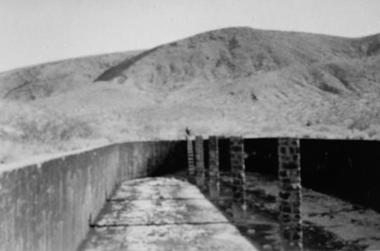
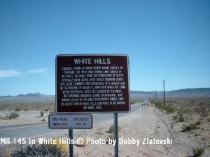
✦ The White Hills 1,000,000 Gallon Water Holding Tank — Still Standing Today ✦
Even though considered wasteful management, the company was enabled to continue substantial production for 4 years because of the large quantity of good ore left by the first company and by the lessees. For a good part of two years after the mill was completed, the south 20 stamps were run on the low grade ores and the high grade ore shipped as before. But management refused to follow their company engineer's advice to development. The company paid promptly, until last payment came due, causing a dispute and litigation, until 1904 when property sold under judgment to Moffat. In 1911, Moffat failed in business, at which time the property passed to Mr. Root's family and litigation again ensued. In 1922, another attempt was made to operate, but because of lack of experience and capital, the property became involved in another litigation which was finally settled in the early 1930's clearing the title for the first time in several years.
Despite $12,000,000 in total ore production for the past six years, in 1898 new strikes stopped, rich veins paid out. Construction and building abruptly stopped — the cost of living soared, so miners and families drifted away.
By 1899, those few hardy stragglers left were ultimately hit by something more devastating… a flood that inundated the town and its mineshafts. White Hills' destiny was sealed. The telephone line was given over to Chloride. Owners closed everything by 1902. In 1903, a 40 stamp mill was installed for a short revival, and again in 1920, with the local paper quoting "20 children in the school" until about 1923. In 1972, a mining company commenced exploration, but found not enough to warrant expense of full development.
Today, over a century after the flood, White Hills is considered a 'true' Ghost Town of Mohave County. Located nearly midpoint on the eastern side of Detrital Valley, 30 miles from Hoover Dam via Hwy. 93, or 39 miles from Kingman on the same highway. A road sign announces its presence to the east of the highway.
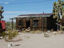
The last remaining building from White Hills — dismantled and relocated to the Golden Horseshoe Ranchos in 1964 by Hal Brown, Ralph Huntzinger, Dan Huntzinger & several other helpers to save it from vandals. Used as a clubhouse until the mid-1970s.
✦ Photo dated 9/24/07 · Courtesy Dan Huntzinger ✦
✦ Source ✦
History of White Hills courtesy of the Mohave Historical Society.
Mohave Museum of History & Arts · Kingman, Arizona
✦ By The Numbers ✦
White Hills — Fast Facts
Oct 20, 1892
Post Office Established
Aug 15, 1914
Post Office Discontinued
2 Weeks
To Reach 200 Residents
1,500
Peak Population
15 Mines
Within One Mile of Camp
$12,000,000
Silver in First 6 Years
White Hills had electric lights, running water, and telephones — remarkable for a remote desert mining camp.
White Hills was soon the largest mining camp in all of Mohave County.
The toughest town between Globe and Virginia City in the 1890s.
When the mines played out, so did the population — today only a few scattered remains survive.
"5 miles east from mile 29 on US 60/US 93 was once a miner town with the name White Hills — the toughest town between Globe and Virginia City in the 1890s. In May 1892, a Hualapai Indian named Jeff searched for iron oxide which he used as face paint, when he found silver ore. He pointed the place to Judge Henry Shaffer who started the first mine in this area. In just two months White Hills reached 200 houses, a general store and saloons. Two years later the town reached a population of 1,500 citizens. In the first 6 years of the town's existence, the 15 mines gave over $12,000,000 in silver. Mines and city disappeared in 1914. Today there are no memories left — only a few scattered remains, mining equipment and foundations."
✦ Submitted by Bobby Krause ✦
"The last picture in this column is the last known building from the original White Hills Ghost Town. We dismantled it and moved it up to the subdivision after several other buildings by the highway were vandalized and burnt down. It was reassembled where it stands now. About 4 months after it was relocated, it started being used as a meeting house — a pot belly stove was added.
The last shaft I remember is gone along with a large section of the hill on the NE side of the road. I remember there was an issue with people trying to climb in the shaft back in the late 60s. Several junk cars and trash were used to fill the shaft to prevent 'us' kids from getting injured entering it. When they reopened the mine, I understand there was a lot of grumbling about the 'trash in the shaft.' There are still some tin cans washed out into the valley from when the town was still booming — not much more.
You have to give those people credit! They built a water reservoir that can still hold water a hundred or so years later. I think I have some old pictures of part of the framing for the roof still intact. If I can figure out which box they're in I'll upload them. When I was out there 4 or 5 years ago there was about 3–4 feet of water in it."
✦ Ray Bale — Eyewitness Account ✦
✦ Photo Gallery ✦
White Hills Today
Photos courtesy of Bobby Zlatevski
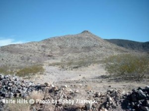
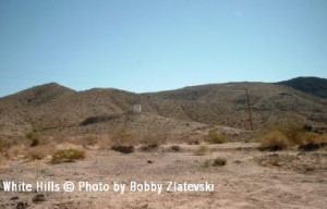
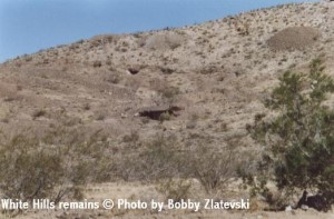
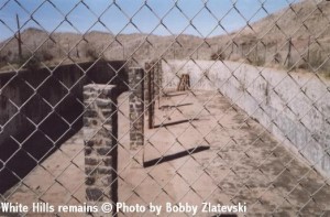
✦ All Photos © Bobby Zlatevski ✦
✦ Historic Archive ✦
White Hills — As It Once Was
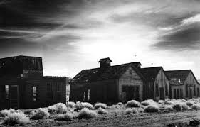
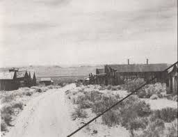
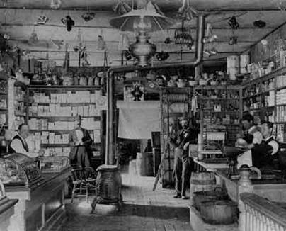
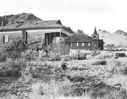
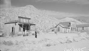
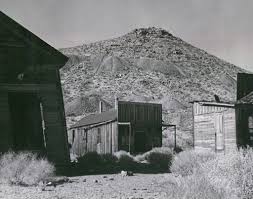

✦ Courtesy Arizona Daily Star ✦
White Hills — The Mining Record
Although not a major producer, the White Hills — a small range of mountains 50 miles northwest of Kingman — is noted for a multitude of small mining operations making up the Indian Secret Mining District in Mohave County. Initial shipments averaged 3,000 ounces of silver per ton.
Soon R.T. Root and D.H. Moffatt, a Denver syndicate later known as the White Hills Mining Co., purchased the property for $250,000 in 1894. They added to their investment with the purchase of mining equipment needed to fully exploit the property — that would soon include 27 miles of tunnels worked by 600 miners.
Water-related challenges emerged including the scarcity of on-site potable water combined with the excessive cost of water haulage. Brief torrential rains instigated gully washers that damaged the town's buildings. Economic challenges caused the White Hills Mining Co. to be acquired by an English company in 1895 for $1.5 million.
White Hills became the largest mining camp in Mohave County, consisting of a population of 1,500 and 15 mines worked within a mile of the camp. In 1895, it was composed mostly of tents serviced by several saloons, restaurants and land staked by squatter's rights. Additional conveniences included running water, electric lights and telephones.
Mine development included a 40-stamp mill, a hand-built water reservoir comprising 7 miles of 7-inch wooden pipeline, and an improved road system. Declining silver prices, excess operating costs coupled by either pinched-out or faulted-off rich ore-shoots forced the mine to close in 1907 after having produced 8 million ounces of silver. The average depth of the mining properties at that time ranged from 50 to 500 feet. A massive flood destroyed the town in 1909.
Later exploration and development of the property included operations undertaken by Floyd R. Brown in the early 1930s resulting in a shipment of 732 tons of silver ore at a profit of $40,000 based on a 60-cent per-ounce silver price and 80 percent mill recovery.
During the 1970s, the underground workings of the G.A.R. Mine were improved by Consolidated Mineral Inc. along with a 370-foot timber-lined vertical shaft and new head frame. A batch-leach plant and mill were built on site. Diamond and percussion drilling, trenching and surface leaching to treat the old mine tailings were attempted by the Arizona Silver Corp. Technology enhancements involved an X-ray fluorescence scanner and probe developed by United Nuclear Industries used to detect silver on the Hulda mine extensions in 1982. Production included the processing of 20-pound Doré bars on site containing 95 percent silver mixed with 3 ounces of gold.
The Hualapai and neighboring Paiute Indians used the iron and manganese oxides commonly found in the White Hills for face pigment. Mining activity on the western flank of the White Hills heightened in 1892 when a Hualapai Indian known as Jeff discovered rich silver chloride vein deposits. He later informed Henry Schaefer, a local miner prospecting in the Gold Basin area, of his discovery. Schaefer invited John Burnett and John Sullivan to exploit the site that became known as Schaefer's Treasure. In some cases the ore was said to run as high as 1,000 ounces of silver per ton. The mining boom began with a 10-stamp mill. Ore was shipped to the Kingman smelter. Profitable mines included the Chief of the Hills, Monster, Hulda, Bonanza and G.A.R. Lode.
Today the flat valley between Arizona 93 and the White Hills is sought over by developers — the area holds interest for retirees who wish to acquire affordable lots of land within a 45-minute drive to Las Vegas. The hills, composed of medium-grained gneissoid granite, are aptly named because of their light-colored appearance.
✦ Source ✦
History of White Hills courtesy of the Arizona Daily Star.
Tucson, Arizona
✦ Courtesy Mindat.org ✦
White Hills — The Mines & Geology
The White Hills district is located about 28 miles north of Chloride, on the western border of the White Hills, at about 3,000 feet elevation. It comprises an area about 2 miles in diameter and is a part of the Indian Secret Mining District — so named because the knowledge of the presence of its mineral was for a long time withheld from the whites by the Indians.
The first discovery of mineral in the district by white men was made by Henry Shaffer in May 1892, through the aid of an Indian known as Hualapai Jeff, who exhibited a piece of rich silver ore at Gold Basin and showed Shaffer its source — where the Indians procured the supply of red iron oxide with which they adorned their faces. The locality is at the site of the Hidden Treasure mine.
After making several locations, Shaffer reported the discovery at Gold Basin and was soon joined by John Burnett and John Sullivan, who also located what later proved to be some of the best mines. The trio began work and were soon shipping very rich ore, some averaging $1,000 a ton. The camp soon became the largest in the region and reached its zenith in 1894, with a population of 1,200. Within a short time the camp was owned by one company — the White Hills Mining Company — of which the chief men were R. T. Root and D. H. Moffatt of Denver. A 10-stamp mill was built early in 1894; in large part to work the dumps, which had grown huge. It was a complete success.
About 1895 the property was sold for $1,500,000 to the White Hills Mining and Milling Company, an English concern with headquarters at London and Colorado Springs. With only a moderate amount of ore in sight, this company installed a new, fully equipped 40-stamp mill — which was never worked to its full capacity and is still standing in good condition at the edge of the hills about one-fourth of a mile south of town — along with an electric-light system and an elaborate water-supply system including 7 miles of 7-inch wooden pipeline, a large reservoir, and iron hydrants of city style, at a total cost said to exceed $150,000. As the company failed to make its final payment, the property was put up at sheriff's sale and bought in by the former owners, Root and Moffatt.
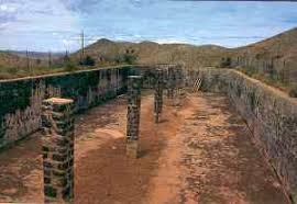
Color photograph of the White Hills 1,000,000 gallon concrete water holding tank — still works today.
✦ Courtesy Kurt Wenner ✦
The developments in the district, some of which extend nearly 1,000 feet in depth, consist principally of inclines, shafts, and drifts, aggregating probably considerably more than 10,000 feet of underground work. A plentiful supply of excellent potable water, ample for milling purposes, is usually reached at a depth of 400 to 600 feet and is present in four of the mines.
While in operation the source of power used in the mills was coal hauled from Kingman, and the Joshua trees — or yucca palms — supplied fuel for the steam hoists at the mines. The principal surface equipment of the camp, besides the mill, hoists, and trams at the mines, includes a large concrete reservoir and numerous mostly vacant frame buildings: offices, stores, dwellings, a church, and a schoolhouse — all but a remnant of the former town situated on White Hills Wash and mostly on Main Street, which trends nearly east and west.
Geology of the District
The country rock is principally light medium-grained gneissoid granite containing garnet, with some associated dark amphibolite schist. The schistosity dips to the northwest but varies greatly, the rock being folded and faulted. It is overlain on the east by Tertiary volcanic rocks, which in turn are capped by younger basalt.
The gneissoid granite — in which all the deposits occur — contains principally orthoclase, quartz, microcline, and garnet. In many places the garnet is abundant, some occurring as large phenocrysts, and locally the rock is traversed by bands or zones fully two-thirds composed of garnets about one-fourth of an inch in average diameter.
The deposits are principally quartz veins, some of which are blanket veins or have a low dip. They average about 3 feet in width and in general dip to the northeast at angles of 20° to 80°. The ore, which seems to be oxidized to the bottom of the mines, contains chiefly chloride of silver with local values in gold, and is usually rich — reported to average about $200 in silver to the ton. A 19-ton carload of ore shipped to the smelter in 1894 is reported to have contained 29,000 ounces of silver and 80 ounces of gold.
The total production of the district is reported to be about $3,000,000. Prior to the acquisition of the property by the White Hills Mining Company, many lessees are reported to have made fortunes ranging from a few thousand dollars to $25,000 each from surface workings alone. During the first fourteen months of its ownership, the White Hills Mining Company shipped ore that netted $242,000 at the Denver smelters — with large shipments of bullion regularly made throughout the period it operated.
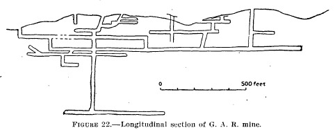
✦ Figure 22 — Longitudinal Section of the G.A.R. Mine ✦
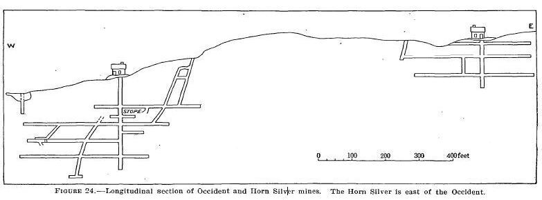
✦ Figure 24 — Longitudinal Section of the Occident & Horn Silver Mines ✦
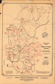
✦ Historic Mohave County Survey Map — Gold Basin & White Hills Mine Locations ✦
✦ Source ✦
Geology and mine history courtesy of Mindat.org — the world's largest open database of minerals and mining localities.
✦ A Town's Life & Death ✦
Timeline of White Hills
1892
Silver Strike
Prospectors discover rich silver deposits in the Hualapai Mountains, triggering a rush that transforms the remote desert into a booming mining camp almost overnight.
1893–1895
Boomtown Years
White Hills swells to a population of over 1,500. Hotels, saloons, a post office, and a school spring up along the dusty main street. The town ships millions of dollars in silver ore.
1896
The Mines Run Dry
The richest veins are exhausted. Miners pack up and move on almost as quickly as they arrived. Within months, White Hills begins its long, quiet return to the desert.
Early 1900s
Ghost Town
Only a handful of stubborn souls remain. The buildings slowly crumble under the Arizona sun. White Hills becomes one of the most complete ghost towns in the American Southwest.
Today
A Legend Lives On
Master Prospector Danny & Master Prospector Jeff still work the land around White Hills, proving the desert hasn't given up all its secrets. Picky's Prospecting Store keeps the spirit of the town alive.
✦ The Fallen of White Hills ✦
White Hills Cemetery
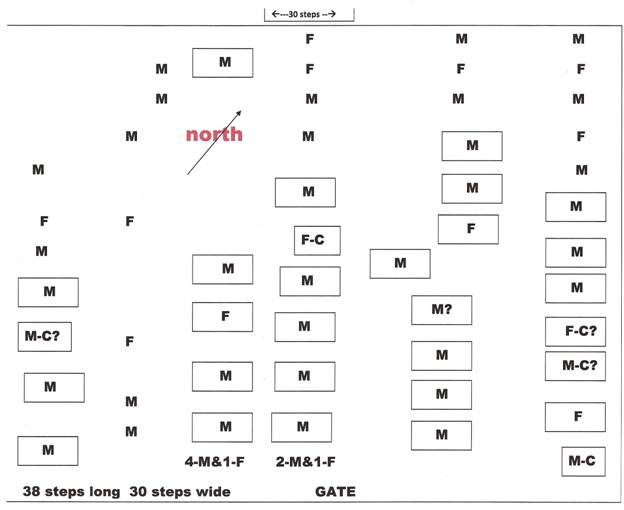
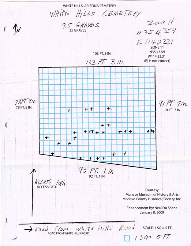
The White Hills Cemetery holds 35 graves — miners, families, and frontier souls who never left. Rock-bordered plots mark the resting places of those who built and lost this boomtown. Cemetery records courtesy of the Mohave Museum of History & Arts and the Mohave County Historical Society.
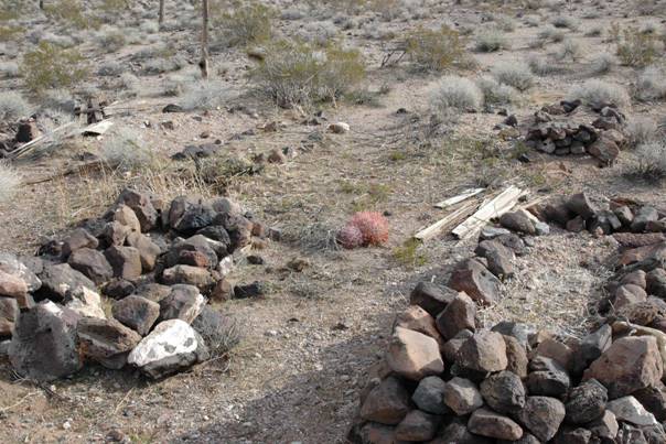
Passed Away in White Hills
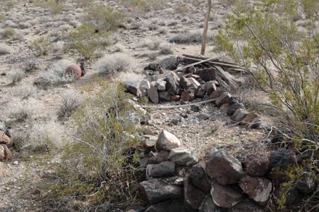
Grave of Unknown Prospector
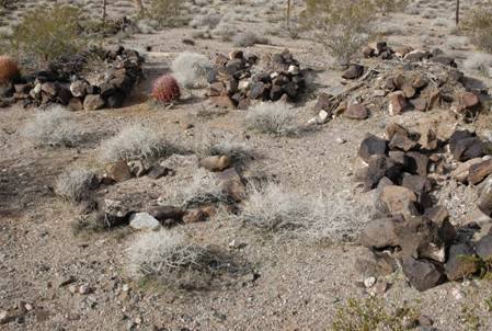
Forgotten Prospectors
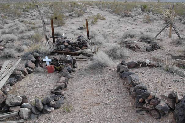
Multiple Grave Sites
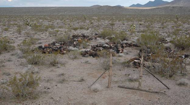
White Hills Cemetery
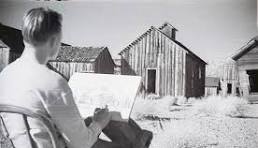
Artist Sketching White Hills
Cemetery Survey Map — 35 Graves · Courtesy: Mohave Museum of History & Arts
Grave Layout Diagram · M = Male · F = Female · F-C = Female/Child
✦ Have You Been There? ✦
The Desert Awaits
White Hills sits just off US Highway 93 — a short detour from the highway that rewards you with one of Arizona's most authentic ghost town experiences. Come for the history. Stay for the pizza.
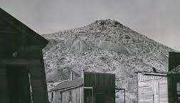
View From Town — Hill Full of Mines
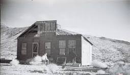
Two Prospectors — White Hills
✦ Rare Historic Photographs ✦
Life in White Hills
Rare photographs from the boomtown years — the people, buildings, and streets of White Hills, Arizona, circa 1892–1896.
✦ White Hills School ✦
Students & Teachers — White Hills Schoolhouse, 1890s
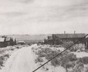
View Down Main Street — White Hills, 1890s
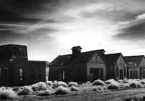
Buildings Lining the Street — White Hills
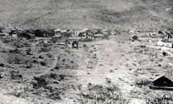
Elevated View — White Hills
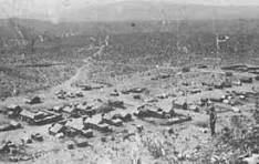
Panoramic View From Hilltop
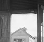
Looking Out From Abandoned Building
Artist at the Ruins
✦ White Hills ✦
View From Town — The Hill Full of Mines
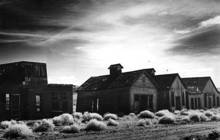
Sunrise — White Hills Downtown
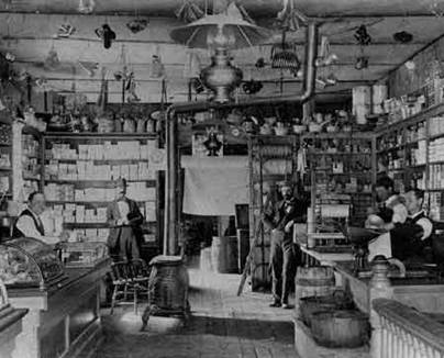
Inside the General Store
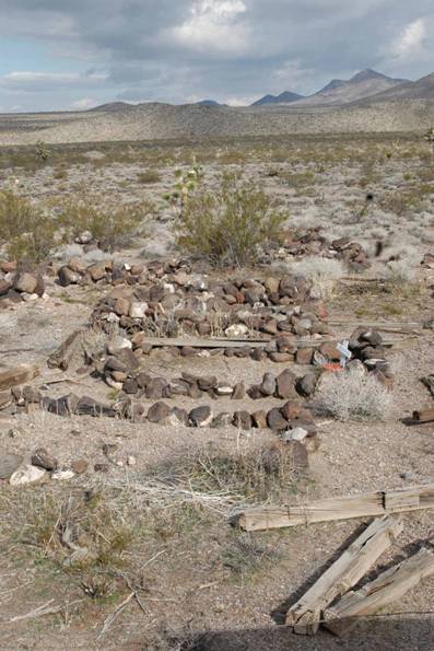
Some of the 35+ Graves
✦ Find White Hills ✦
Getting Here
White Hills sits along US Highway 93 (Old Interstate 11) in Mohave County, Arizona — roughly halfway between Las Vegas and Kingman, deep in the Hualapai Valley.
From Las Vegas, NV
~65 miles south
Take US-93 S / I-11 S toward Kingman. White Hills is on your right.
From Kingman, AZ
~47 miles north
Take US-93 N / I-11 N toward Las Vegas. White Hills is on your left.
From Laughlin, NV
~50 miles east
Take AZ-68 W to US-93 N. Follow US-93 north into White Hills.
✦ Picky's Prospecting Store ✦
20606 N US Hwy 93, White Hills, AZ 86445
Off Interstate 11 (Old Hwy 93) between Las Vegas NV & Kingman AZ
Open in Google Maps✦ Opening Very Soon ✦
Come Experience the Legend
World Famous Flat Earth Pizza, frontier burgers, two museums, and the ghost town of White Hills — all in one legendary stop on US Highway 93.